The transformation of Alanya over the past 20 years is shocking! Here are the published satellite images
Satellite images from the past, publicly released by Google, reveal changes in many parts of the world. Here is the transformation of Alanya over the past 20 years.
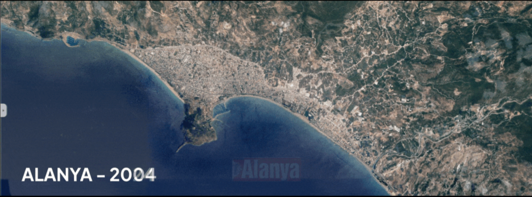
One of the common complaints of the residents of Alanya has been the loss of the city’s natural landscape. Thanks to Google’s published Google Earth Timelapse service, the changes over the years in any location around the world can be seen. The transformation of Alanya has been shockingly visible through this service.
Here is the transformation of Alanya over 20 years
Google’s historical satellite image archive is a tool used to observe geographical and structural changes on Earth and offers great opportunities for researchers, historians, urban planners, and environmental scientists. This archive can be accessed through platforms like Google Earth and Google Earth Engine, and especially with the Google Earth Timelapse feature, users can examine the changes of specific regions over the years.
What is Google Earth Timelapse?
Google Earth Timelapse presents satellite images from 1984 to the present on a timeline. This feature allows users to dynamically observe environmental and structural changes in a region, such as urban development, deforestation, climate changes, and agricultural expansion. The images, obtained with the support of satellite data providers like NASA, Landsat, and Sentinel, are processed by Google’s algorithms to offer the ability to analyze annual changes.
In-depth Analysis with Google Earth Engine
Google Earth Engine is an advanced platform for more detailed analysis. Useful in fields like environmental research, urban planning, and natural resource management, this platform combines global satellite images with big data processing capabilities. Researchers and experts can process satellite data, develop environmental models, and create historical datasets on the platform.